Log in
All resources
Create a design
451 Free Artworks of Maps Of North America
bibliothèque nationale de france
maps in the library of congress
a map of the british empire in america with the french and spanish settlements adjacent thereto
maps by tomas lopez
smithsonian libraries
lawrence h. slaughter collection of english maps, charts, globes, books and atlases
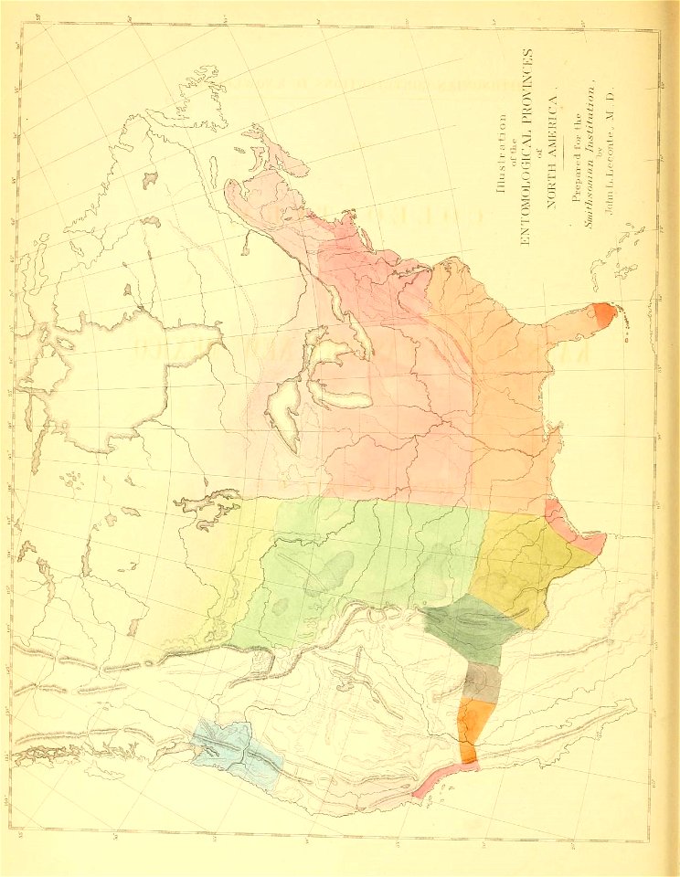
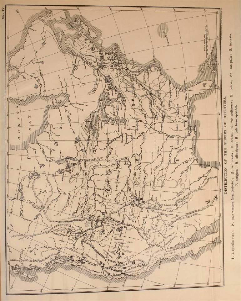
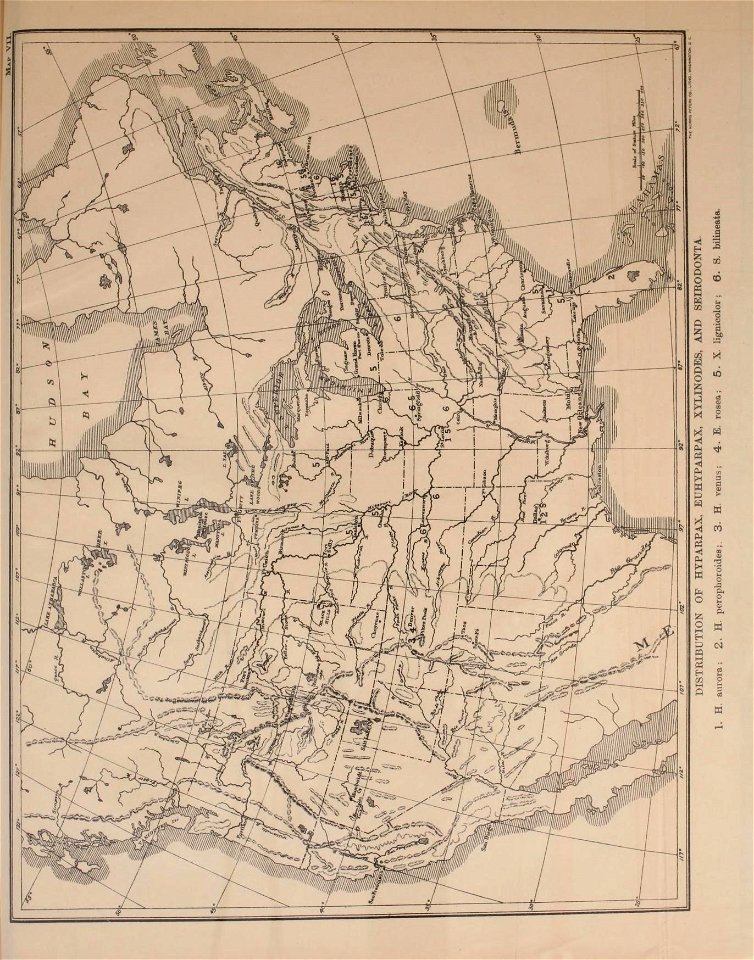
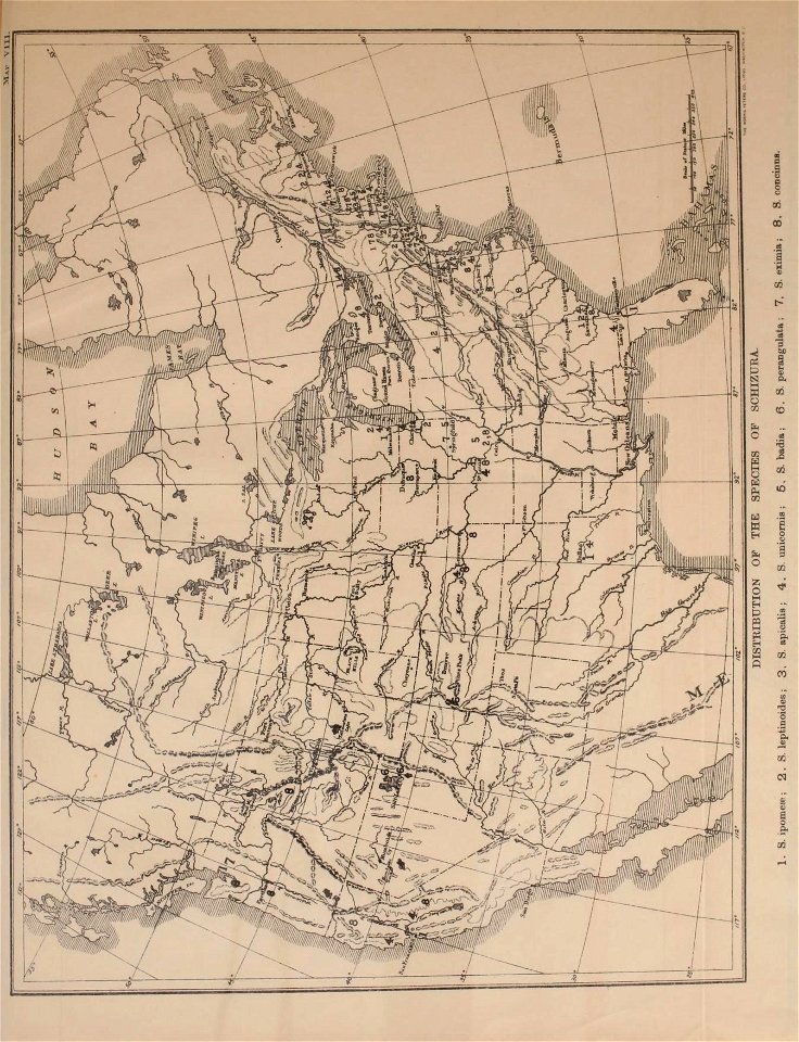
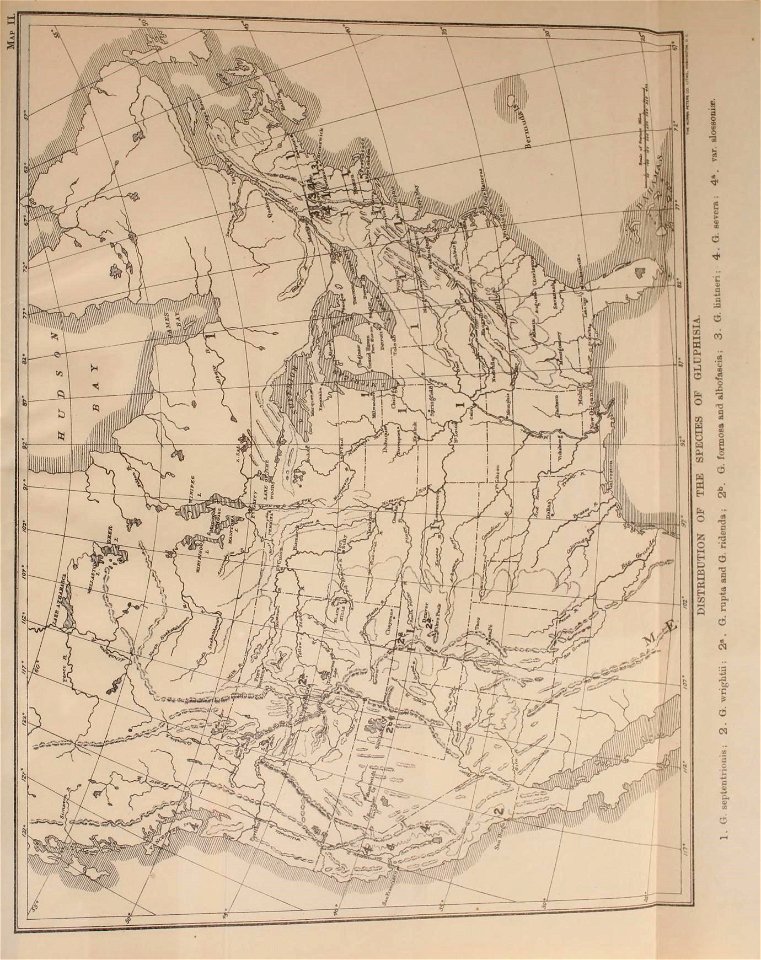
insects
considérations géographiques et physiques sur les nouvelles découvertes au nord de la grande mer
moth
lepidoptera
maps in the library of congress
1755 maps of north america
maps indicating exploration
royal geographical society
maps in the library of congress
1718 maps of north america
a map of the british empire in america with the french and spanish settlements adjacent thereto
bibliothèque nationale de france
a map of the british empire in america with the french and spanish settlements adjacent thereto
bibliothèque nationale de france
a map of the british empire in america with the french and spanish settlements adjacent thereto
bibliothèque nationale de france
a map of the british empire in america with the french and spanish settlements adjacent thereto
bibliothèque nationale de france
a map of the british empire in america with the french and spanish settlements adjacent thereto
bibliothèque nationale de france
a map of the british empire in america with the french and spanish settlements adjacent thereto
bibliothèque nationale de france
a map of the british empire in america with the french and spanish settlements adjacent thereto
bibliothèque nationale de france
a map of the british empire in america with the french and spanish settlements adjacent thereto
bibliothèque nationale de france
a map of the british empire in america with the french and spanish settlements adjacent thereto
bibliothèque nationale de france
a map of the british empire in america with the french and spanish settlements adjacent thereto
bibliothèque nationale de france
a map of the british empire in america with the french and spanish settlements adjacent thereto
bibliothèque nationale de france
a map of the british empire in america with the french and spanish settlements adjacent thereto
bibliothèque nationale de france
a map of the british empire in america with the french and spanish settlements adjacent thereto
bibliothèque nationale de france
a map of the british empire in america with the french and spanish settlements adjacent thereto
bibliothèque nationale de france
a map of the british empire in america with the french and spanish settlements adjacent thereto
bibliothèque nationale de france
a map of the british empire in america with the french and spanish settlements adjacent thereto
bibliothèque nationale de france
1842 maps of north america
ambroise tardieu
1680s maps of north america
hugo allardt
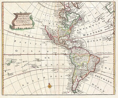
1740s maps of the americas
1747 maps of north america
lawrence h. slaughter collection of english maps, charts, globes, books and atlases
atlas novus (blaeu)
lawrence h. slaughter collection of english maps, charts, globes, books and atlases
atlas novus (blaeu)
island of california on world maps
1680s maps of the world
lawrence h. slaughter collection of english maps, charts, globes, books and atlases
atlas novus (blaeu)
maps by willem and johannes blaeu
1610s maps of the americas
maps in the library of congress
18th-century maps of martinique
maps by louis brion de la tour
1786 maps of north america
1673 in new york city
24 august
a map of the british empire in america with the french and spanish settlements adjacent thereto
1730s maps of the caribbean
description de l'universe
old maps of north america
lawrence h. slaughter collection of english maps, charts, globes, books and atlases
novi belgii, atlas maior
atlas maior, vol 12 (america) - joan blaeu, 1667 - bl 114.h(star).12
1667 maps of north america
maps in the library of congress
1785 maps
mammals
maps
considérations géographiques et physiques sur les nouvelles découvertes au nord de la grande mer
hokkaido in art
18th-century maps of new orleans
maps in the library of congress
bibliothèque nationale de france
maps by thomas kitchin
old maps of st. augustine, florida
john white (colonist and artist)
1593 maps of north america
cornelis de jode
maps in the library of congress
1765 maps
french-language maps
1742 maps
maps in the library of congress
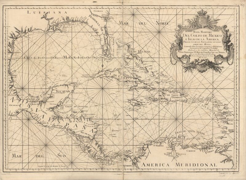
1758 maps of cuba
maps in the library of congress
1750s maps of the caribbean
considérations géographiques et physiques sur les nouvelles découvertes au nord de la grande mer
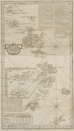
isla de los estados
a map of the british empire in america with the french and spanish settlements adjacent thereto
bibliothèque nationale de france
maps in the library of congress
1760 maps of north america
maps in the library of congress
1779 maps of new york (state)
a map of the british empire in america with the french and spanish settlements adjacent thereto
bibliothèque nationale de france
maps by john cary
1799 maps
1750s maps of central america
maps by tomas lopez
maps in the library of congress
old maps of florida
a map of the provinces of new york and new jersey, with a part of pennsylvania and the province of quebec
lawrence h. slaughter collection of english maps, charts, globes, books and atlases
a map of the provinces of new york and new jersey, with a part of pennsylvania and the province of quebec
lawrence h. slaughter collection of english maps, charts, globes, books and atlases
1750s maps of central america
maps by tomas lopez
insects
maps
a map of the provinces of new york and new jersey, with a part of pennsylvania and the province of quebec
lawrence h. slaughter collection of english maps, charts, globes, books and atlases
maps in the library of congress
1773 maps of the united states
1779 maps of new york (state)
old maps of new york (state)
maps by bernard ratzer
maps by thomas kitchin
frontispieces from england
maps by william faden
old maps of the russian empire
1790s maps of alaska
considérations géographiques et physiques sur les nouvelles découvertes au nord de la grande mer
old maps of the yellow sea
1750s maps of california
philippe buache
maps by pieter mortier
maps from gallica
science
maps
maps in the library of congress
old maps of latin america
insects
maps
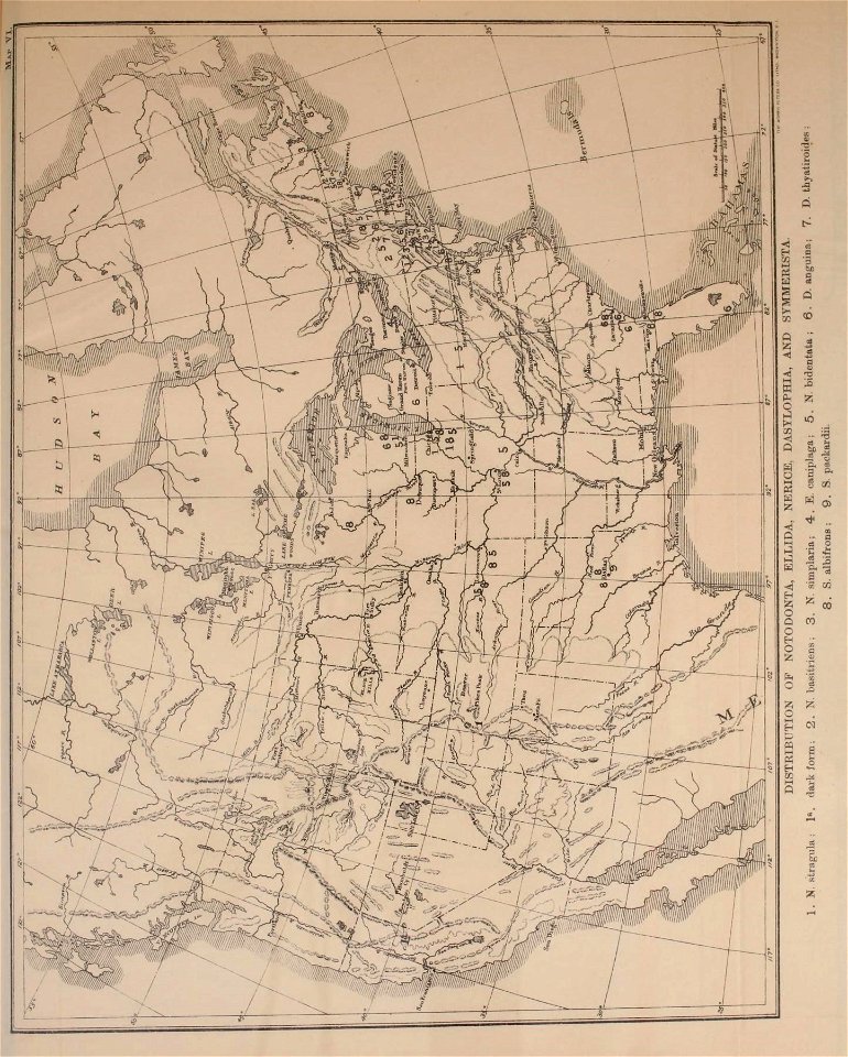
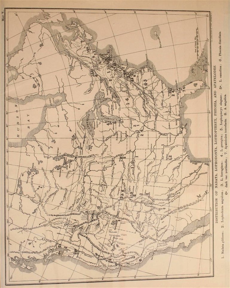
a history of land mammals in the western hemisphere (1913)
a history of land mammals in the western hemisphere (1913)
insects
maps
considérations géographiques et physiques sur les nouvelles découvertes au nord de la grande mer
eso island
considérations géographiques et physiques sur les nouvelles découvertes au nord de la grande mer
isla de los estados
considérations géographiques et physiques sur les nouvelles découvertes au nord de la grande mer
eso island
a history of land mammals in the western hemisphere (1913)
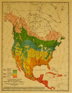
1876 maps of north america
1876 maps of the caribbean
maps in the library of congress
cartouches by tomas lópez
colonial history of the united states
old maps of new york (state)
st. augustine, florida in the 18th century
1783 maps of north america
carte de l'amérique septentrionale by guillaume delisle (1700)
1700 maps of north america
lawrence h. slaughter collection of english maps, charts, globes, books and atlases
maps by claude joseph sauthier
maps in the library of congress
18th-century maps of jamaica
french-language maps of north america
1809 maps of north america
bird
maps
maps in the library of congress
1758 maps
maps in the library of congress
1780s maps of cuba
insects
maps
insects
maps
a history of land mammals in the western hemisphere (1913)
old geological maps by jean-etienne guettard
jean étienne guettard
native american history of virginia
17th-century maps of virginia
maps in the library of congress
1776 maps of new jersey
maps in the library of congress
1780s maps of the caribbean
george heriot (artist)
george heriot
broadsheet prints from koninklijke bibliotheek - maps
broadsheet prints from koninklijke bibliotheek
george heriot (artist)
george heriot
the generall historie of virginia (john smith)
1624 books from london
insects
maps
insects
maps
201 - 300 of 451
Next page
/ 5